Drone tree inventory · Christmas trees

Know your stock. Every tree, every size, before you sell.

Astova flies your plantation with a survey drone and delivers the number of trees per parcel, the height of every tree in your size classes, and a map you can open on your phone. Results are typically ready within 48 hours of the flight.
Proven on a real field

7,224
trees counted on one field
8
parcels, each with its own count
every tree
located and measured individually
± 15 cm
checked against 18 tape-measured trees

Every tree on a real field

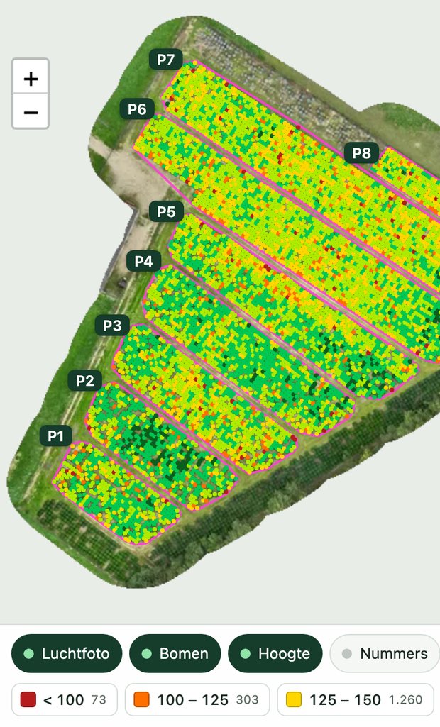
This is an actual plantation we flew, with all 7,224 trees measured. Move around it, zoom in, and tap any tree to see its number and its height.

Drag to move around. Use + and − to zoom. Tap any tree for its number and height.

Loading the map
Tap a tree for its number and height. Open the full map

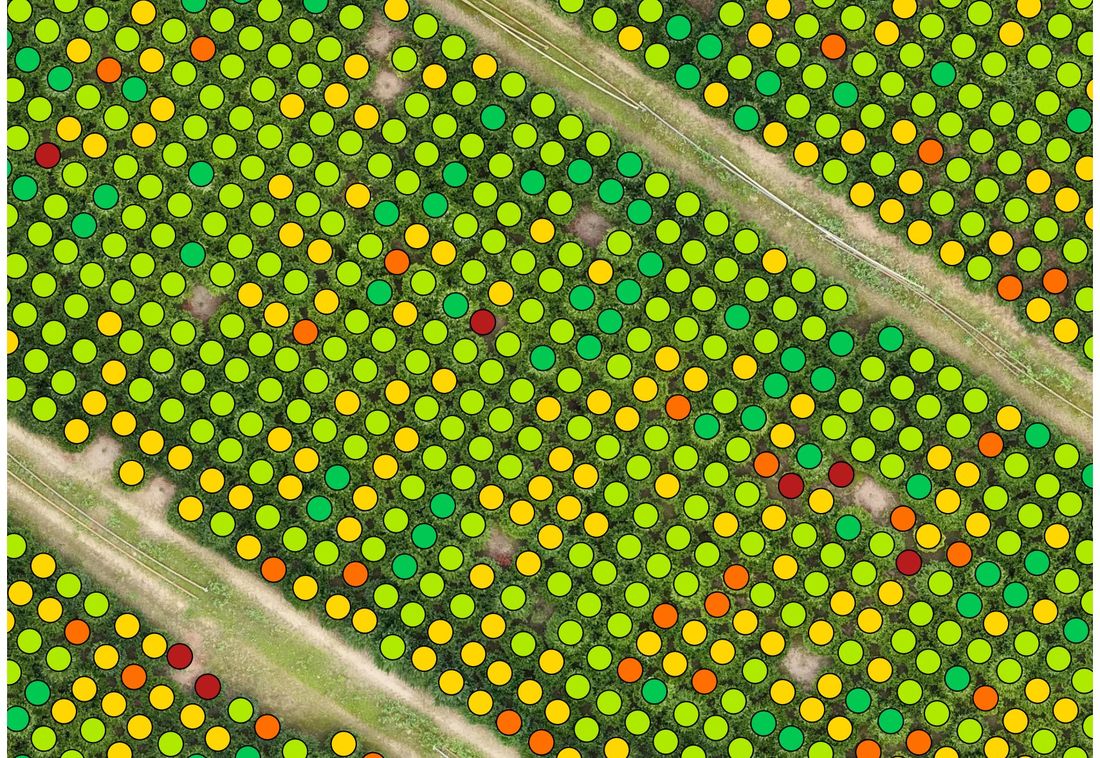
Every circle is one tree, coloured by its measured height class. Real result from a field in Limburg, 2026.

What you receive

Four deliverables, two days after the flight

Counts per parcel

The number of trees per parcel and for the whole field, with the gaps visible on the map.

The height of every tree

Each tree sorted into your size classes, for example 150 to 175 cm, with the number per class and per parcel.

A map on your phone

Zoom into the aerial photo, tap a tree for its number and height, switch classes on and off, look up a tree number.

A report and a tree list

A few pages you can share with buyers, your trader or your bank, plus an Excel list with the position, height and class of every tree.

Who it is for

Three people who need the same numbers

Growers

Plan the season on real stock

Know before the season how many saleable trees you have per size. Plan cutting and pre-sales on real numbers, not on planting records from years ago.

Traders

Check a field before you pay

An independent count and size mix before you buy a field standing. No more estimates from a walk around the edge.

Buyers and exporters

Book transport against real figures

Check the size mix you are paying for, and plan pallets and lorries on measured numbers.

How it works

One flight, and you do not need to be there

01

The flight

We fly the field with a survey drone. A small field takes about half an hour.

02

The measurement

The photos become a 3D model in which every tree is found and measured. We check a number of trees with a tape in your own field.

03

The delivery

Typically within 48 hours you receive the map, the report and the list.

In the field

The same map in your pocket

The map opens on any phone, with no app to install. Stand in the crop, tap the tree in front of you, or search a tree number and walk straight to it.

The tree map open on a phone, showing parcels and coloured trees
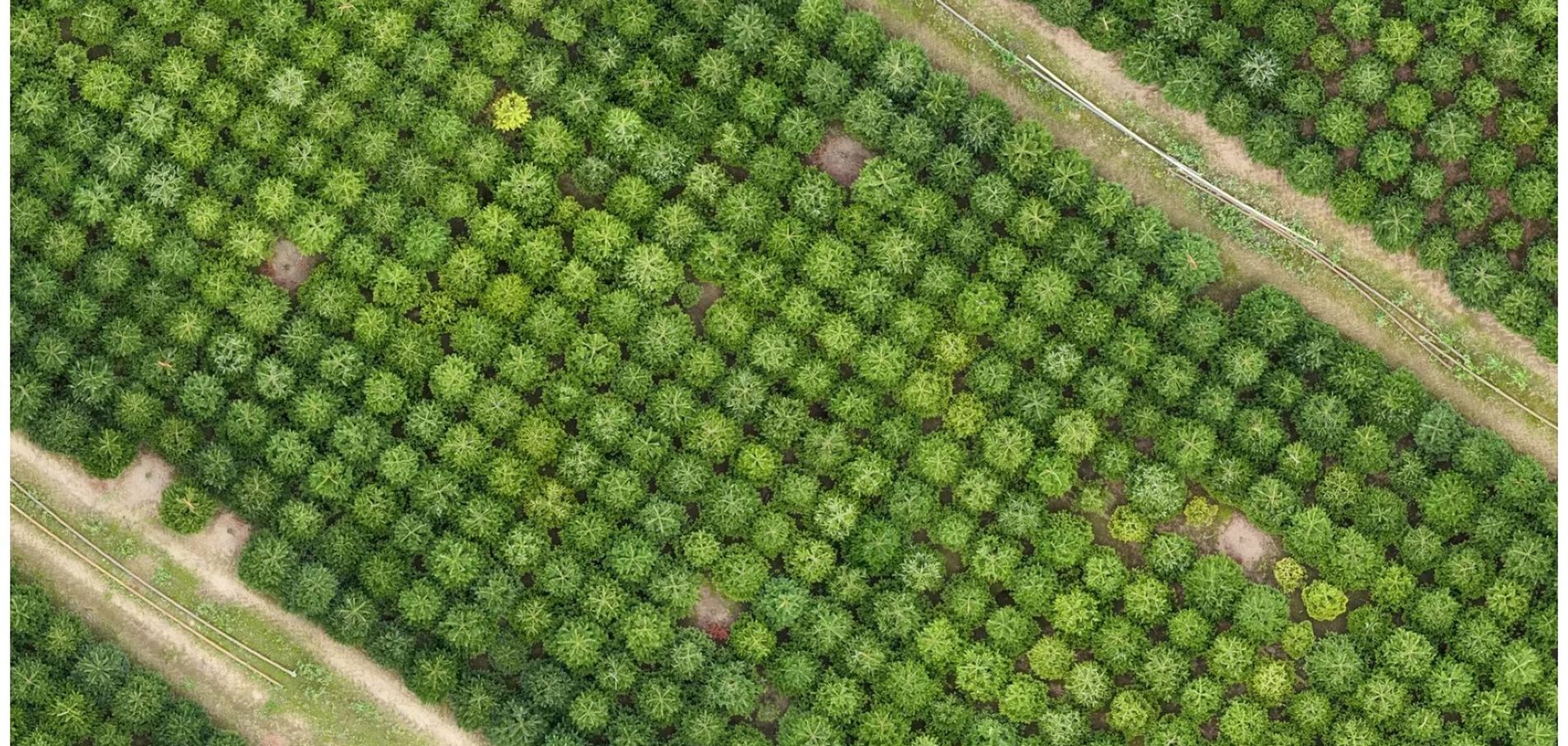
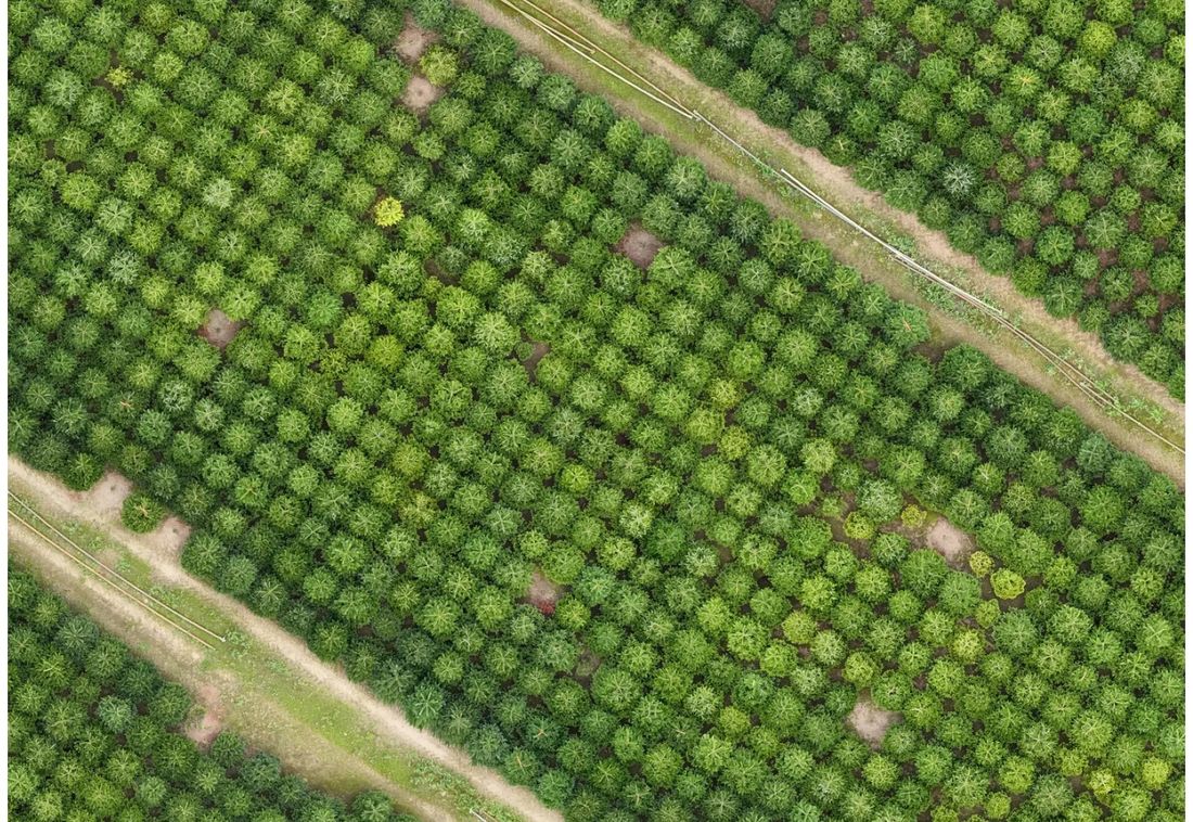
Aerial photograph of Christmas tree rows
The aerial photo.
The same rows with every tree coloured by its measured height class
The same trees, each in the colour of its measured height class.

How accurate

Measured the way you measure

Heights are taken from the soil at the stem to half the leader, the way growers measure. On our first field, 18 trees measured with a tape agreed with the drone within 15 cm, with a typical difference of 11 cm. Every report states the accuracy measured in your own field, so you know what the numbers are worth.

Get in touch

Tell us about your field

Send the location and rough size and we will tell you what a flight involves, what it costs and when we can come. No obligation.

One-page overview: English Nederlands Deutsch

We reply within one working day.

Thank you. Your message has been sent and we will come back to you within one working day.